On August 22, 2017, two Nelson, British Columbia, residents successfully completed a circumnavigation of Mulvey Basin in Valhalla Provincial Park, bagging all 13 peaks. Vince Hempsall shares their story.
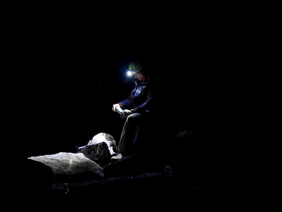
The headlamp beam glared off the white surface of the golf ball, forcing me to squint to make out the black cursive lettering: “Miracle Flight+ 2”. Appropriate considering we’d need some good fortune to complete the mission we had just embarked on. I placed the ball back on the rock where I found it beside its twin and a golf club and finished hiking the 20 metres to the summit of Mount Dag, one of the tallest peaks in the Valhalla mountain range.
It goes without saying a nine iron and two golf balls are strange items to find on top of any mountain peak. But the fact it was 2:30 in the morning and my climbing partner, and mountain guide, David Lussier and I were embarking on a quest to traverse 13 peaks of the Mulvey Basin in under 24 hours, made the discovery even more surreal.
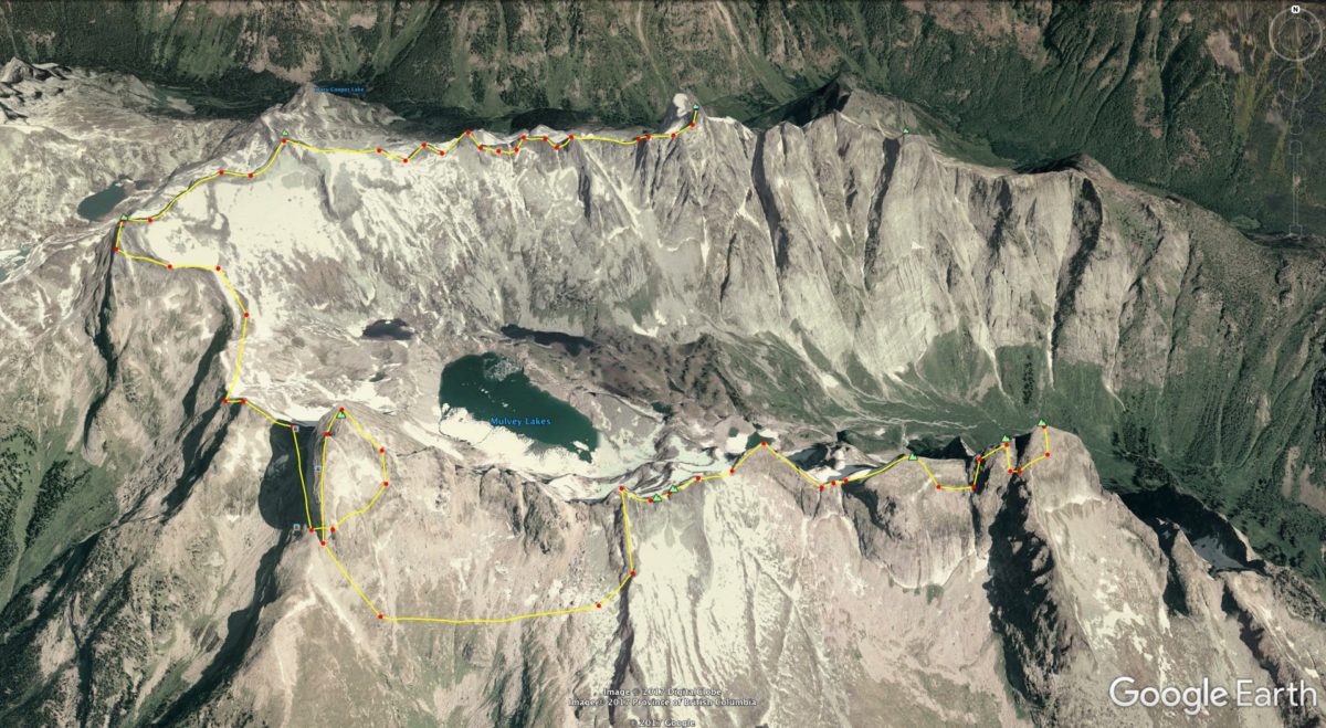
This was our second attempt of this traverse in as many years and the forecast was perfect: clear skies with zero percent chance of precipitation. Then again, good weather was predicted for our first attempt in 2016 and that ended with us cowering under a boulder during a freak electrical storm at 8,500 feet.
As David signed the register on the summit of Dag, I continued thinking of my bizarre discovery. Why a nine iron? Why not a driver? Surely that would be a lot more satisfying. I imagined teeing up and driving a ball across the two-kilometre-wide span that separated us and Gladsheim Peak, the final destination of our mission. Suddenly all thoughts of golf vanished as David asked, “You ready?” He had replaced the register in its waterproof canister, slotted it back in the stone cairn and was looking at me expectantly. It was time to descend from the summit, collect our bivouac gear and start the 12-kilometre circumnavigation of Mulvey Basin: 13 peaks, eight of which we’d have to rock climb, and over 2,300 metres of elevation gain. At that moment, I wished I could’ve just soared over to Gladsheim as well.
Located in the southern end of Valhalla Provincial Park, the horseshoe-shaped Mulvey Basin is ringed by some of the most beautiful and iconic mountains in British Columbia. On the Northern rim is Asgard Peak, a perfect pyramid rising up from the ridge line. Due south is Gimli Peak, which looks like the prow of a massive battleship barrelling towards the American border. Then there’s the aptly named Wolf’s Ears. All are incredible pieces of rock that boast world-class alpine routes and when done individually, make for a wonderful day of climbing.
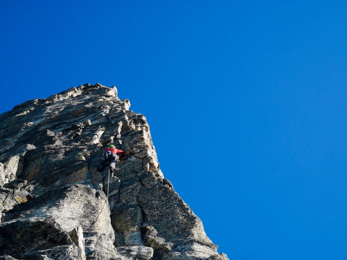
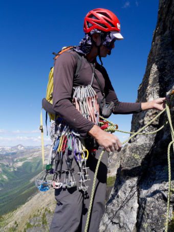
Doing all the peaks in one day is a different story, however. No one had ever attempted such a feat. It requires intimate knowledge of the routes up the peaks as well as the fastest way to reach them across the scree. Physical stamina is a given but so is mental fortitude because, in the interest of saving time, all climbing needs to be solo (without ropes) or simul-climbing. The latter style involves two climbers, connected by a rope, climbing a route at the same time. The seconder follows the leader and removes the gear the leader puts in the rock to protect a fall. Despite having a safety rope, however, a fall while simul-climbing is still bad as both parties could plunge dozens of metres and hit ledges. So really, falling is not an option.
Finally, to think of doing a traverse of all the peaks in the Mulvey Basin in less than a day requires a bit of lunacy. And I believe Dave and I are guilty of that. After all, this wasn’t our first stamina adventure involving Gimli Peak: five years ago we bicycled the 86 kilometres from our homes in Nelson to the Valhalla Provincial Park, hiked to Gimli Peak, simul-climbed the south ridge and returned home again in 21 hours. This couldn’t be worse, right?
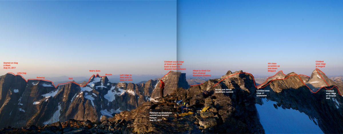
The itinerary of our trip had us bivouac on the south face of Dag, about 100 metres below the summit and waking up at 2am to bag the summit. We’d then descend, collect our gear and scramble and climb the Nott-Dag traverse in reverse tagging Little Dag, Batwing and Mount Nott along the way. Following that we’d climb the Wolf’s Ears from East to West, run up the Muzzle and then descend via the Robertson-Gimli couloir and make our way to Gimli Peak. All of which went perfectly well until we reached the South Ridge of Gimli.
Despite it being early on a Tuesday, there were already parties lined up for the South Ridge by the time we got there. One group was on the first pitch, one was putting on gear and another had given up and was preparing to do the alternative start to the route. We approached that couple and told them our plan and they graciously allowed us to go in front of them. We quickly dumped our overnight gear at the base and started simul-climbing the nine pitches to the top. It took us an hour and a half to complete them.
We walked off via the East ridge descent, picked up our overnight gear and hiked to the Gimli- Nisleheim col where we again donned climbing shoes and simul-climbed the East Ridge of Nisleheim. We reached the peak around noon, changed back into our approach shoes, and did the fourth class scramble down the Northwest Ridge.
It’s at this point I need to stress just how much walking is involved with the Mulvey Basin traverse. It’s a detail you rarely hear in terms of adventures but I obsessed about it as we trudged across the long expanse of moraine from Nisleheim to Midgard Peak. Hillary, Lewis and Clarke, Amundsen – those guys traipsed along forever but history doesn’t record such a mundane act of putting one foot in front of the other. Instead, we celebrate their destinations.
Later I would learn from David (who’s in the process of authoring a guidebook to the Valhallas) that the first peaks to be climbed in this area of the Valhallas were done so in 1953. Leon Blumer and Gordon Hartley marched in from the North via the old Gwillim Creek trail for many kilometres before scrambling up the Humps (East and West) and the East Molar. Ironically, we would not be accessing those peaks on this excursion because they are not a true part of the horseshoe around the basin but rather overlook Mulvey Creek from a lower vantage.
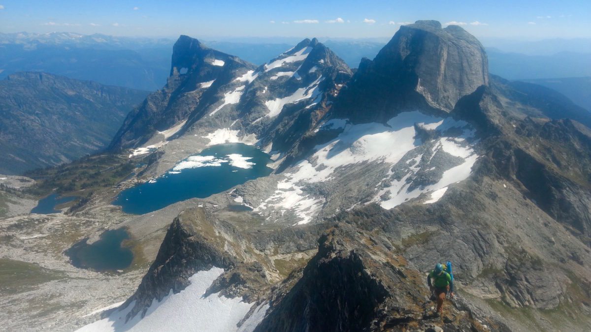
Instead we elected to finish the traverse on Gladsheim, which, at 2830 metres, is the tallest mountain in the Valhallas. And as we scrambled up the low fifth class to the Midgard Peak and learned it was still early afternoon, we started to think we might just accomplish that. But I remained cautious given our experience from a year ago.
From Midgard we descended the Northeast Ridge, hiked the fourth class terrain to the base of Asgard and then enjoyed simul-climbing the spectacular Southwest Ridge to its summit. That route is so incredible we briefly forgot how tired we were feeling after having been on the move for over 14 hours. We reached the peak, descended the East face and contoured around to the Trireme Wall where another amazing route awaited us, the Integral West Ridge. First done in the 1960s, this route was originally graded 5.5 (or relatively easy for beginner climbers) but as I clung desperately to a lichen-strewn flaring corner on the North-facing wall, I couldn’t help but think that grade was a colossal sandbag. (David says he’ll probably grade it a bit harder in his book.)
We tagged the top of the Trireme Wall and then continued along the ridge to the Trireme col, which was our highpoint during last year’s attempt. I thought back to that moment, on July 30th, when we stared west at the approaching thunderhead clouds. No storm had been forecasted for that day but it was obvious things were about to get very, very scary. Our hearts sank. We were so close! For one insane moment, we both thought about trying to beat the storm and ascending Gladsheim but then realized we’d be stuck on the highest peak around, carrying metal climbing gear in an electrical storm. Not smart. Instead we retreated. But the storm came on so quickly we only made it about 100 metres down the col when we were hammered by a downpour. We spotted a cave and crawled in (leaving our metal equipment at the mouth of it) and spent the next half hour being assaulted by rain and thunder. Lightning flashed every 30 seconds or so. A hundred kilometres to the east revellers at the Kaslo Jazz Fest also noticed the encroaching storm. It would crash into them 30 minutes later in the middle of Michael Franti’s set but his band would continue playing through the temptest.
Back in the cave we noticed the lightning had passed and the rain was starting to subside a bit so we gathered our things and continued down the couloir, eventually finding a bivy spot beside a large boulder. We endured a miserable night shivering in our soaked sleeping bags while rain fell sporadically. The following day the rock was too wet to climb so we hiked out of the basin, dejected, and returned home. But we resolved to attempt the traverse again one day.
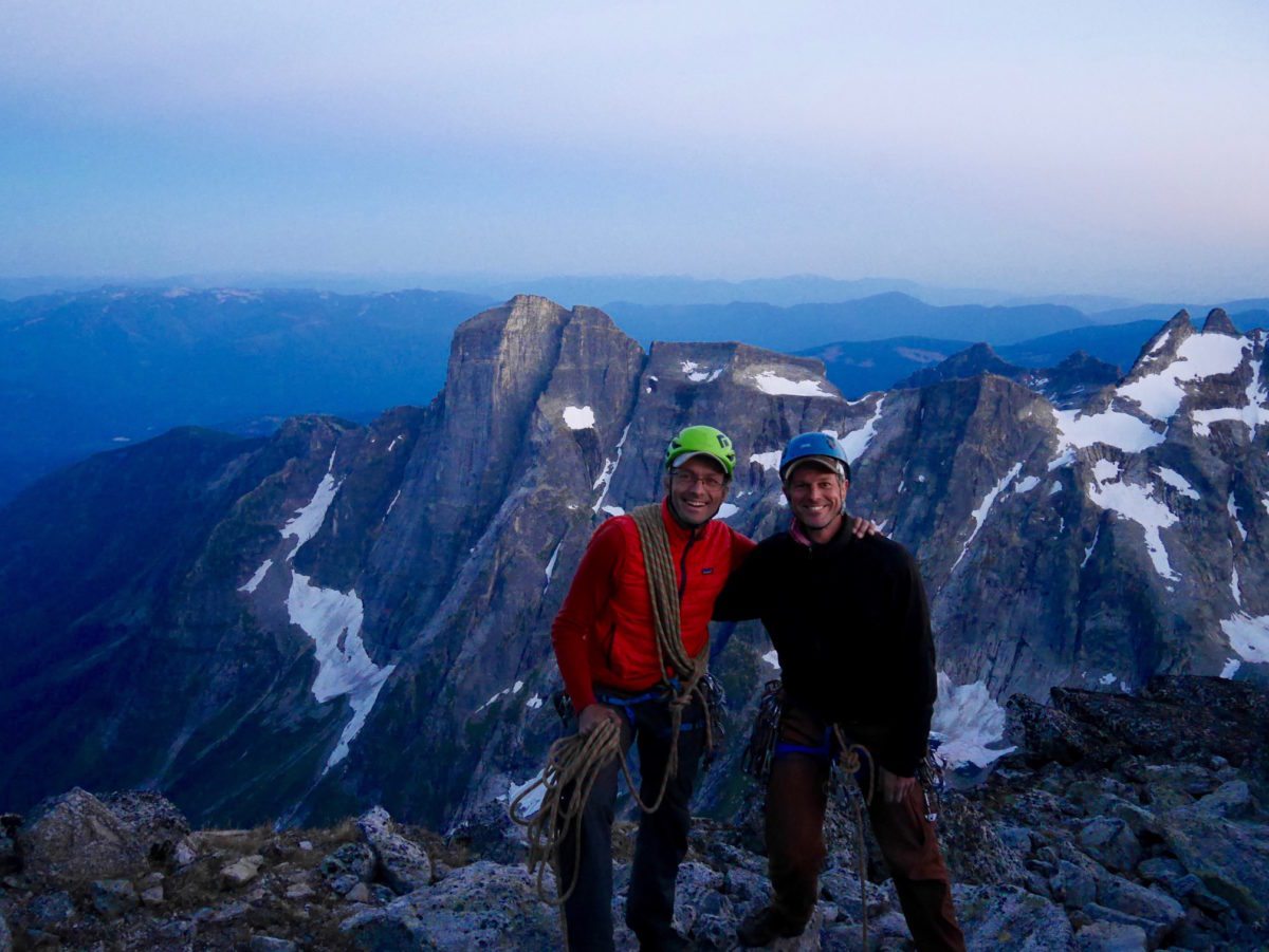
This year, looking out from the Trireme col, we were relieved to see clear skies in all directions. But the light was starting to dim. It was 6:30pm and we still had a long ridge to scramble and three pitches of rock climbing to do before we could reach the peak. We ignored our exhaustion and set off. David kept asking if I wanted to rope up but I felt we couldn’t waste time so I waved him off. At one point I second-guessed that decision, though, when I was straddling a knife-edge of rock with one leg dangling down the north face and the other dangling over Mulvey basin.
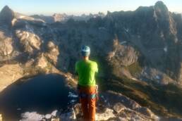
But I persevered and we reached our bivouac spot about 100 metres below the summit without incident. We dumped our overnight gear, grabbed our headlamps and scrambled to the peak of Gladsheim just as the sun was setting on the horizon. It was 8:20pm. We had walked, climbed and scrambled over 12 peaks for the past 16 hours to get to this spot. We snapped a few photos and then I sat down and watched the light fade from burnt orange to purple. David posted a shot to Facebook (amazingly there’s cell service at the top of Gladsheim) and then we descended to our bivy where we stretched, ate and then collapsed into a restless slumber. I dreamt of flying.
Photo Slideshow:
[foogallery id=”11571″]
[divider type=”line” margintop=”40″ marginbottom=”40″]
The Mulvey Basin Traverse Itinerary – By David Lussier
The goal was to ascend the 13 named peaks encircling Mulvey Basin in one day. In counter-clockwise order, they include: Mount Dag (2750m), Little Dag (2725m), Batwing (2650m), Mount Nott (2600m), East Wolf’s Ear (2750m), West Wolf’s Ears (2750m), the Muzzle (2700m), Gimli Peak (2810m), Nisleheim Peak (2650m), Midgard Peak (2810m), Asgard Peak (2830m), The Trireme Wall (2715m) and Gladsheim Peak (2830m). The route involves about 12km of linear distance and 2300m of elevation gain. There are numerous single-rope rappels required, endless 4th class scrambling and multiple pitches of simu-climbing up to 5.10a.
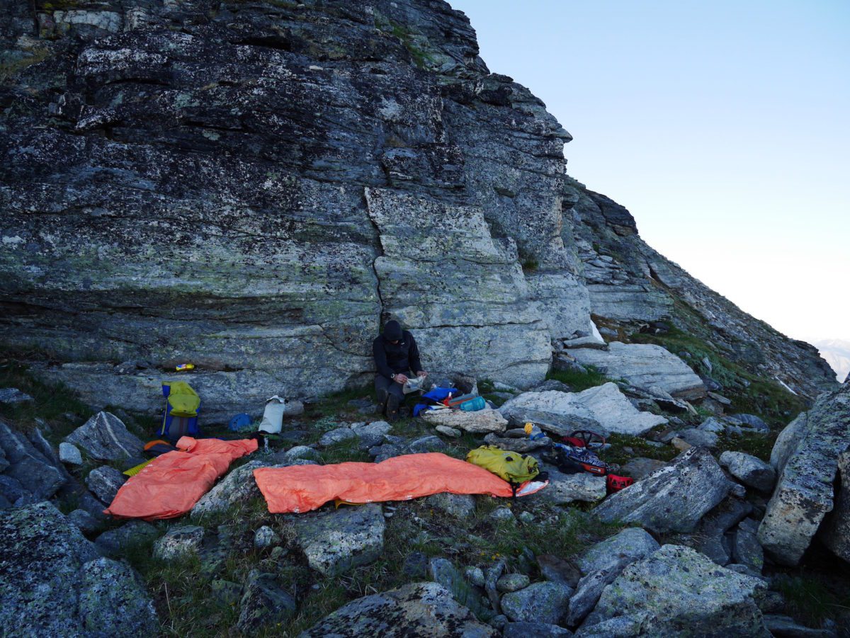
Start: Bivouac on the south shoulder of Mount Dag at 2660m. Awaken at 2am and scramble to the summit of Mount Dag.
Dag to Nott: Scramble and climb the Nott-Dag traverse in reverse (PD+, 5.5, A0) and tag Little Dag, Batwing and Mount Nott.
Nott to Muzzle: From the col, traverse the Wolf’s Ears from east to west (AD, 5.6), then tag the Muzzle.
Muzzle to Gimli: After descending the hidden couloir from the Robertson-Gimli divide, contour around the Gimli Basin at approximately 2325m to the base of Gimli Peak and climb the South Ridge (D-, 5.10a). Descend via the East Ridge and return to the base of Gimli to collect overnight gear.
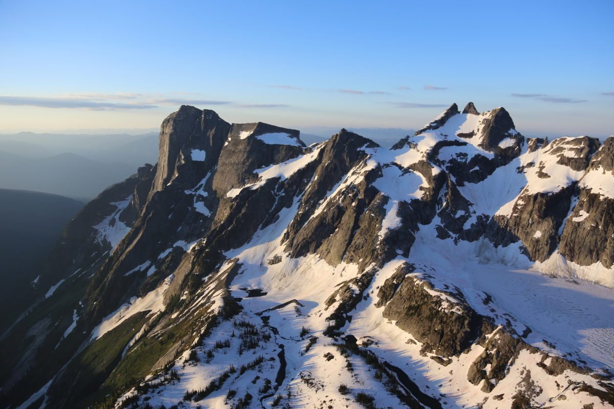
Gimli to Nisleheim: Traverse below the West face to the Gimli-Nisleheim col then climb the East Ridge of Nisleheim (AD-, 5.7).
Nisleheim to Midgard: From the Summit, descend the Northwest Ridge (4th class) to the Nisleheim-Midgard Col then walk to the base of Midgard Peak and ascend via the Southeast Ridge (PD, 5.1).
Midgard to Asgard: Descend the Northeast Ridge (4th class) and follow the height of land on 4th class terrain to the base of the Southwest Ridge of Asgard. Climb the Southwest Ridge (AD, 5.7).
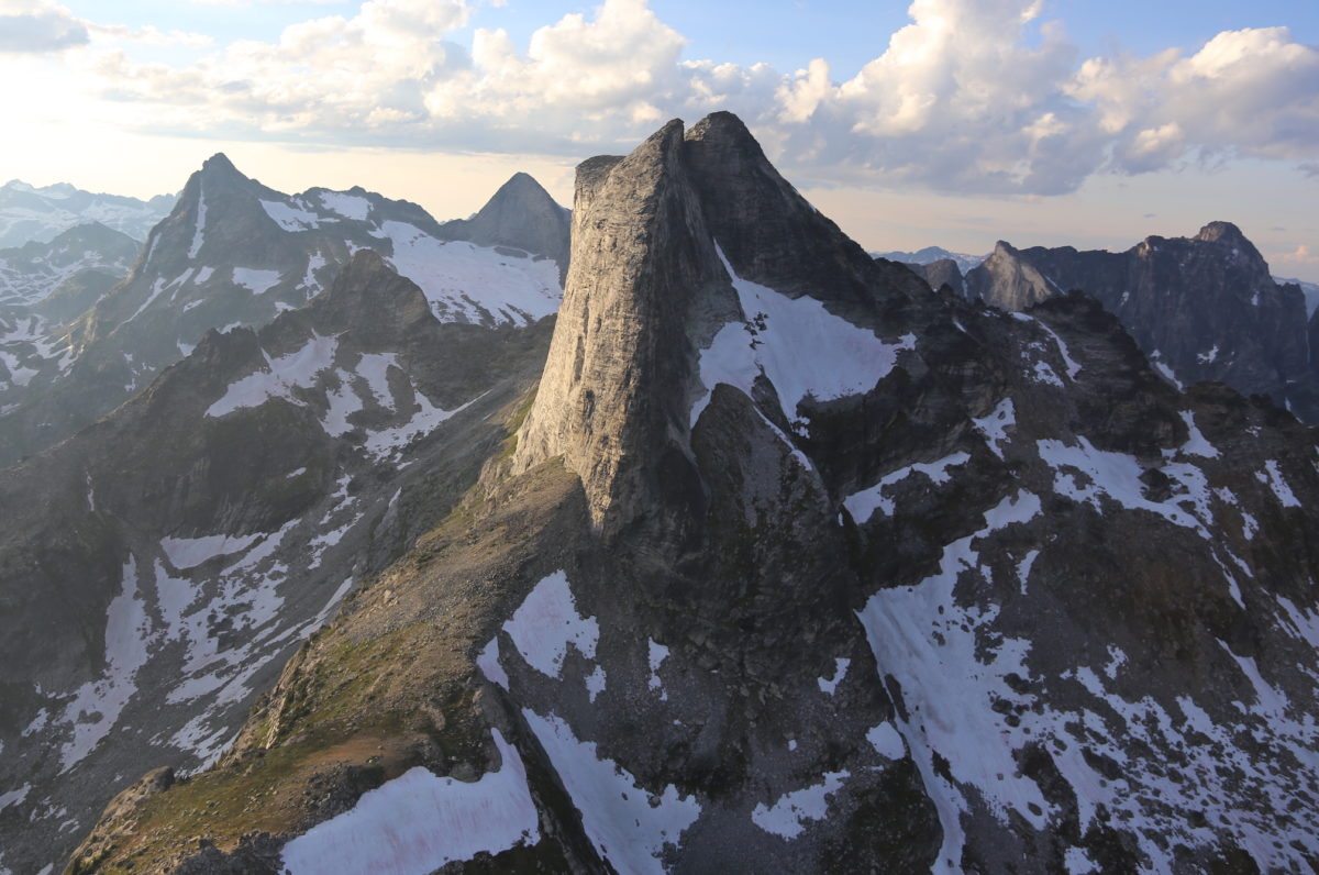
Asgard to Trireme Wall: Descend via the regular East face (3rd class) to 2475m. From here, contour eastward towards the Trireme Wall. Climb the Integral West Ridge of Gladsheim (AD+, 5.7) and tag the top of the Trireme Wall.
Trireme Wall to Gladsheim Peak: Continue along the West Ridge to the peak of Gladsheim (AD+, 5.7). Summit at 8:20pm then descend to an exposed bivouac site at 2750m.
Finish: The following morning descend the West ridge to the Trireme Couloir, scramble down to Mulvey Basin, hike through and back to the trailhead via the Gimli col trail.
Vince Hempsall
Vince Hempsall lives in the beautiful mountain town of Nelson, British Columbia, where he spends his time rock climbing, backcountry skiing and mountain biking (when not working). He is the editor of Kootenay Mountain Culture Magazine and online editor for the Mountain Culture Group.
Related Stories
Lucky 13 – Mega Nuts Creekboating
“Lucky 13” by Castlegar’s Dainty Deathy Productions, is a seriously gnarly adventure into the creekboating…
KMC and Columbia Basin Trust Launch The Headwaters Podcast
This week, Kootenay Mountain Culture Magazine and Columbia Basin Trust launch a new podcast called The Headwaters. The…
Sun Peaks Invests $350,000 in its Bike Park
The Sun Peaks Bike Park marks its 20th anniversary this summer with an investment of $350,000 in upgrades and new…
Columbia Basin Trust Spending $2 Million on 42 Heritage Projects
The Columbia Basin Trust is currently supporting 42 heritage projects around the Kootenay region with over $2 million.…
Shred Hard Summer Camp Coming To Sun Peaks Aug 26-30
The Shred Hard Camp is just one of many events happening at Sun Peaks Resort near Kamloops, British Columbia in August…
Sun Peaks Is Getting Snowbombed April 5-9
Snowbombing Canada returns to Sun Peaks resort near Kamloops, British Columbia April 5-9. The headliner is world-famous…


